


The panel of experts constituted by the regional Government last year after the September Gota Fría to examine ways of minimising the risk of floods
in the Region of Murcia, has highlighted 13 stretches of water channels on which it believes improvements could be made to reduce flooding around the Mar Menor.
The panel proposes a series of actions on 13 stretches of channels that cause "severe risks" of flooding in the Mar Menor, which mainly correspond to to the Ramblas de la Maraña, Cobatillas, La Higuera, El Albujón, el Miedo and la Carrasquilla.
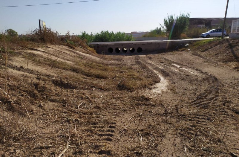
The experts have analyzed the main channel that crosses the plain where the Campo de Cartagena and the municipalities of the Mar Menor are located, the La Rambla del Albujón, which has a length of 42 km.
Outside of the structure of the rambla the natural water run-offs lack permanent structure and are formed by a series of channels and natural run-offs; should these be altered, as has occurred through various developments and agricultural activity, then the balance of the flow is interrupted and the water runs off into different areas, forming pools of excess water and flooding.
The Minister of Development and Infrastructure, Díez de Revenga explained that the experts suggest " focusing on the problem as a whole, addressing it as a whole, from the top to the bottom of the basin", because the basin that discharges into the Mar Menor has an area of 1,235 km2 and a distance of more than 60 kilometers, "so that floods can occur with rainfall produced in places far from the one that suffers its consequences" as was clearly witnessed last September when more than 200 litres per square meter fell inland in the Torre Pacheco municipality, and subsequently flooded large areas around the Mar Menor when millions of litres of mud-laden water overflowed into the surrounding urbanisations and countryside.
The experts counsel that the flow of the water should be correctly directed and channelled to minimise the floods, and this can be done by working on 13 separate sections of channels.
The panel maintains that work in the water channels would help to reinforce the security of the residents of Los Alcázares, San Javier, San Pedro del Pinatar, Cartagena and Torre Pacheco.
The panel has requested that the Segura Hydrographic Confederation (CHS) carry out retention works in all the channels in the catchment area; carry out the demarcation of the channels of public domain in the water transport zones and build the necessary channeling for the 13 sections identified as higher risk, all clearly identified and included within the Segura Basin Flood Risk Management Plan drawn up by the CHS.
The regional Government should undertake reforestation actions in the headwaters of the basin and promote good agricultural practices to guarantee the correct continuity and connection of the drainage systems.
And the town halls should “reinforce urban discipline” to prevent any works that modify the channels taking place.
The president of the La Plataforma Stop Inundaciones of Los Alcázares, Santiago Pérez, said that the plan was "very discouraging" as the works recommended could take up to 10 years.